|
|
|||||||||||||||
 |
|
Meteosat-7 direct disseminatation services will terminate on 1 Febuary 2006
* The NOAA-12 and NOAA-15 spacecraft have similar orbits, and both transmit their APT imagery at a radio frequency of 137.5 MHz. If the satellites should come within ~6000km of each other, ground receiving stations could potentially receive transmissions from both satellites simultaneously, which would result in a garbled image. So if the satellites should approach within 6000km of each other (i.e. the satellites are said to be 'in conflict'), usually the 137.5 MHz transmitter aboard the older NOAA-12 spacecraft is switched off. However occasionally NOAA-15 is switched off instead. NOAA-12 orbits slightly faster than NOAA-15, completing 14.25071335 earth orbits per day, compared with 14.24238665 orbits of NOAA-15. These numbers look very similar, but the difference between them (0.0083269) means that every 120.1 days NOAA-12 will complete one more orbit than NOAA-15. So roughly speaking, every day NOAA-12 'gains' on NOAA-15 by ~375 km. At this rate, NOAA-12 and 15 will remain within ~6000 km of each other for ~30 days. With NOAA-12 lapping NOAA-15 once every 120.1 days, and with the spacecraft too close to each other for ~30 days, either NOAA-12 or NOAA-15 APT transmissions are switched off for about one month in four. During the times that NOAA-12/15 is switched off, you may wish to monitor the current whereabouts of NOAA-12 and NOAA-15 as they play tag with each other around the globe. RN Northwood is testing a new frequency for their fax transmissions on 12390 KHz.. They ask for reports from any person receiving it and promise a QSL in response. Source: Ignacio Cembreros Plan NOAA15 VTX-1 (APT data) TURNOFF on 13 Nov at 19:00z through 15 Dec 05. Mauro Giroletti, Italy reported that Northwood (charts for the Gulf region) has a new frequeny in use, 12.390 KHz, logged at 13;00 UTC Mauro Giroletti, Italy reported that Rome Meteo is again active on 8146 KHz alternate 4777 KHz, with bad signal with multipath. All HF radiofacsimile, HF voice and NAVTEX weather broadcasts from United States Coast Guard station NMG in New Orleans, LA have been restored. As a permanant change, the Boston radiofacsimile broadcast has been expanded to include Hurricane Danger/High Wind Warning Charts transmitted at 0452, 1028, 1824 and 2228 UTC. See the complete schedule at http://weather.noaa.gov/pub/fax/hfmarsh.txt NOAA will change NOAA-18 APT frequency from 137.9125 MHz to 137.100 MHz Allen Woodruff (Moderator) has setup a HF-Fax group, if you ever wanted to receive HF marine fax charts on your computer from coast guard stations and see the charts being processed on your computer. you will be able to see satellite IR images wind and wave, sea and surface temp charts and many more. if this interest you and you would like to process these charts on your computer using your soundcard in your computer. all you need is a shortwave radio that has the abilty recieve upper & lower sidebad and a outside antenna. if you are interested in this feel free to join my group. 05 June NOAA 18 is scheduled to turn on the IR sensors and the satellite should transmit normal images like the other NOAA satellites at that time NOAA-N successfully launched from Vandenberg AFB, California, will gather information for weather prediction and climate research across the globe. Launched 20 May 05 at 10:22:02. All deployments (solar array, VTX, SRA, UDA antennas) completed nominally by 11:48Z. Boost phase nominally completed, orbit handover achieved 11:50Z
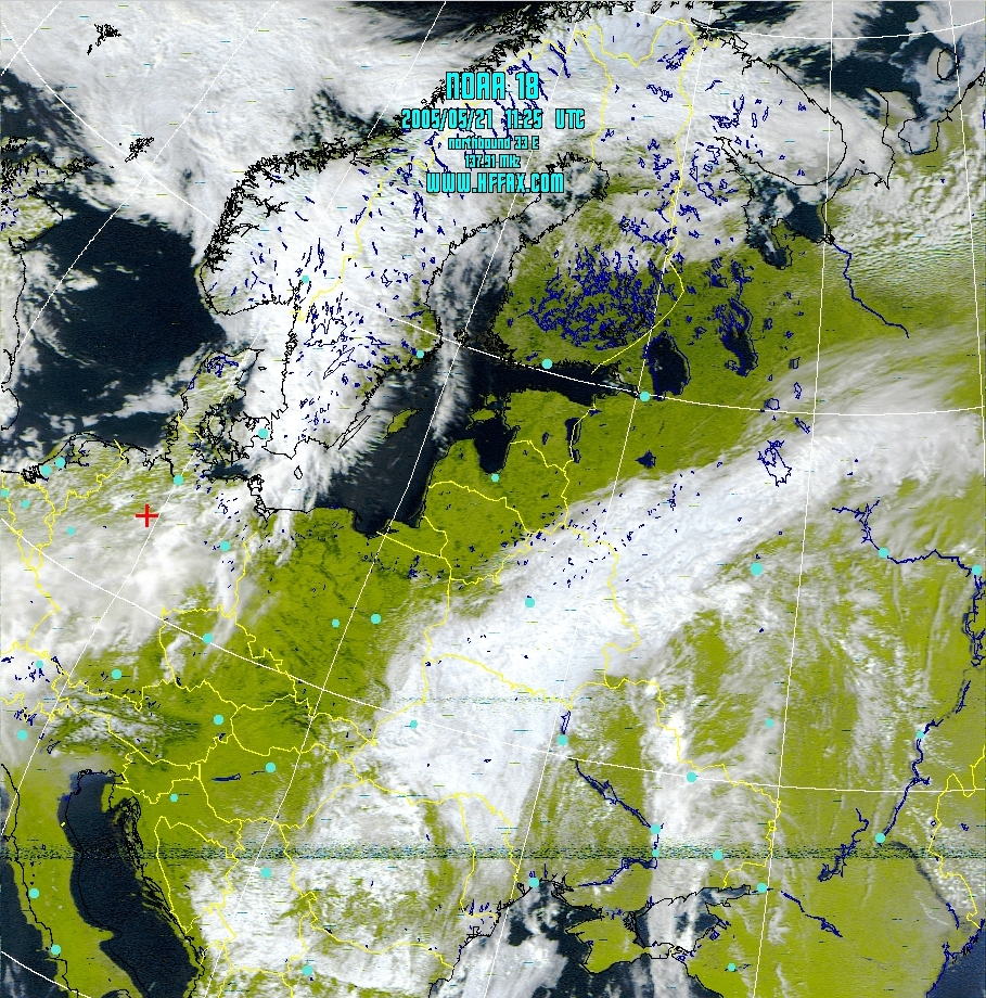
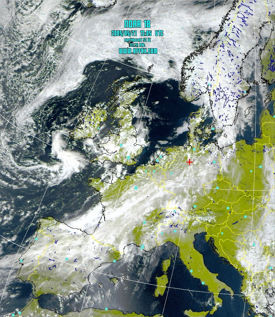
Try to decode the first days when NOAA N is operational the enchangements Vegetation. After launch, NOAA-N will be renamed NOAA-18. NOAA N or NOAA-18 will transmit APT on either 137.9125 MHz or 137.10 MHz. NOT on 137.62 MHz or 137.50 MHz! NOAA 18 is now sending APT images from its orbit on 137.9125 MHz. Since the IR equipment is not yet operational, 2 VIS channels are being sent for the next few weeks. Operational Date: June-10-2005. Added new Facsimile schedule for Tokyo Meteo (JMH) click here. I have added the new schedules from USCG Kodiak. Pt. Reys. and Honolulu. Effective June 15 2005 USCG Kodiak, Alsaka effective June 15. 2005 Or go direct for the latest schedule to http://weather.noaa.gov/pub/fax/hfak.txt USCG Pt. Reyes (NMC) effective June 15. 2005 Or go direct for the latest schedule to http://weather.noaa.gov/pub/fax/hfreyes.txt Honolulu Meteo (KVM) effective June 15. 2005 Or go direct for the latest schedule to http://weather.noaa.gov/pub/fax/hfhi.txt Look at the first images from NOAA 18 passes over Europe Image 1 and Image 2
J-Track from NASA. 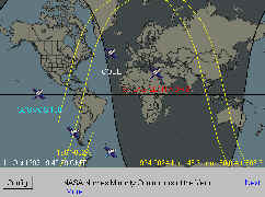 The tracking system calculates an approximate location for a list of satellites. The tracking system calculates an approximate location for a list of satellites.I have added this Link to NASA to my pages Mauro Girolettu, Italy has reported, that Rome Meteo is on air at 4777,7 and 8146,8 KHz Northwood (GYA) now also on 16.155 KHz, source: Mauro Giroletti. Frequencies Northwood: GYA 2618.5 kHz GYA 4610 kHz GYA 8040 kHz GYA 11086.5 kHz GYA 16155 kHz (New) During recent testing of the NOAA-N spacecraft at Vandenberg Air Force Base, California, NOAA encountered a technical problem with one of the mission data transmitters. With NASA and the spacecraft contractor, Lockheed Martin, NOAA have investigated the problem, assessed the need for replacing the transmitter and analyzed the mission impact, if NOAA use the transmitter "as is." NOAA have determined that the problem is not generic in nature and that the best course of action is to replace the one transmitter with an existing spare. This will move the launch date for NOAA-N from March 19 to May 11 (TBC). The launch time remains at 2:22 a.m. PST (3:22 a.m. PDT) with a ten minute launch window. After launch, NOAA-N will be renamed NOAA-18 (APT 137.100) and will provide measurements of the Earth's surface and atmosphere that will be entered into NOAA's weather forecasting models and used for other environmental studies. Each day, the satellite will send data to NOAA's Command and Data Acquisition station computers, adding vital information to forecasting models, especially over the oceans, where conventional data is lacking FLEET WEATHER AND OCEANOGRAPHIC CENTRE NORTHWOOD (New schedule 11 June 2004) Area: Gulf
*Note: All times are GMT/UTC Eddy Waters found a UNID on 11.502 KHz who transmitt at 12:10 UTC a forecast chart from NWS TPC/National Hurricane Center Miami, Florida. This frequency is not a official frequency from USCG New Orleans (NMG), who transmitt normally these charts. Ary Boender, Netherlands (WUN Member) found a UNID fax station from Russia at 7727.5 KHz. This UNID station sends aeronautical charts from the Hydrometeorological Centre of Russia in 120/576 mode Take a look of some charts which has ary Boender received: Chart 1 Chart 2 Chart 3 Chart 4 Chart 5 A bibliography of references, articles, publications and Books, refer to the history of facsimile. To see the page click here Change in Pt Reyes frequency from 12730 to 12590.5 khz Source: Tim Rulon NOAA The meteo FAX service of the Hellenic National Meteorological Service is testing daily at about 0850 UTC using old charts dated 31 March 2004. SWA16 4481.4 kHz NOAA-12 experienced a power system anomaly and went into a Power Survival Safe State around 2300Z on July 25. This mode places the satellite in a power safe state by shutting off the instruments (AVHRR, HIRS, SEM, MSU). Engineers are investigating the anomaly. Initial investigation is showing a solar array or battery cell problem Note: Recovery operations underway. AVHRR return to service expected NET 27 Jul. SEM and AVHRR status declared Yellow until recovery. Updated several HF-fax schedules, see schedules Ted, JA2GZZ is living in Japan. he is aa SLOW SCANNER . He inform me, that they having in Japan the SSTV convention every year. They are going to manage THE 15TH SSTV CONVENTION in SHIZUOKA JAPAN next year. So he want to inform it to DX stations, visit this Website JMH ceased two frequencies. looks like JMH is no longer using 9970 khz, and 23522.9 khz JMH 3622.5 khz JMH1 7505 khz JMH4 13597 khz JMH5 18220 khz Source: Raymond Prestridge Weatherford, Texas, USA Raymond Prestridge Weatherford, Texas, USA wrote: JMH (Tokyo Meteo) has ceased operations on 9970 khz. This would be JMH3, I believe. I have not received them broadcasting on 9970 khz for maybe a month now, and I notice their test charts and MANAM no longer indicate using this frequency. That's too bad, since 9970 khz was where I typically got the best results from them. Here in the southwestern US, JMH2 on 7305 many times has some heterodyne type interference that ruins the reception.JMH's other frequencies do well at times, but 9970 and 7305 are (were) presently the most dependable. Note from me: the latest schedule from 25th Mar 2004 did not mention this. STATUS OF HF RADIO BROADCAST (JMH) AT RTH TOKYO (Submitted by Hiroyuki Ichijo (Japan) )
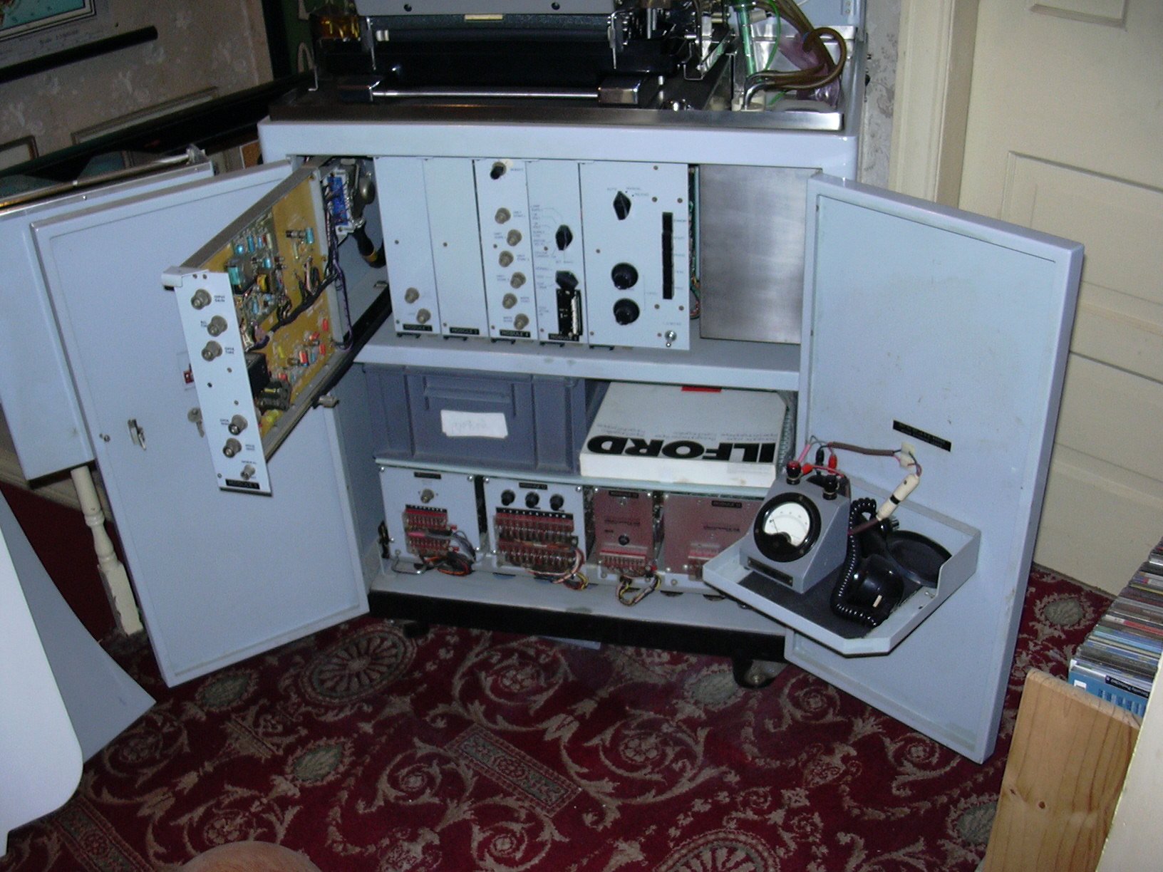
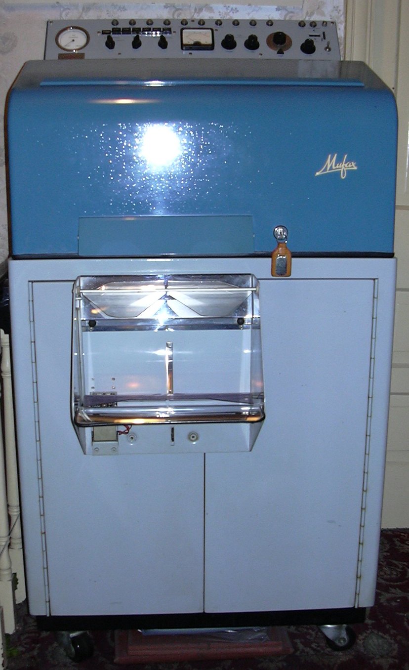
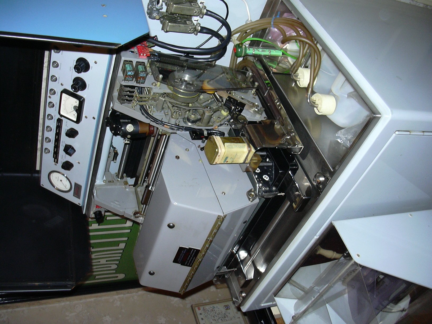
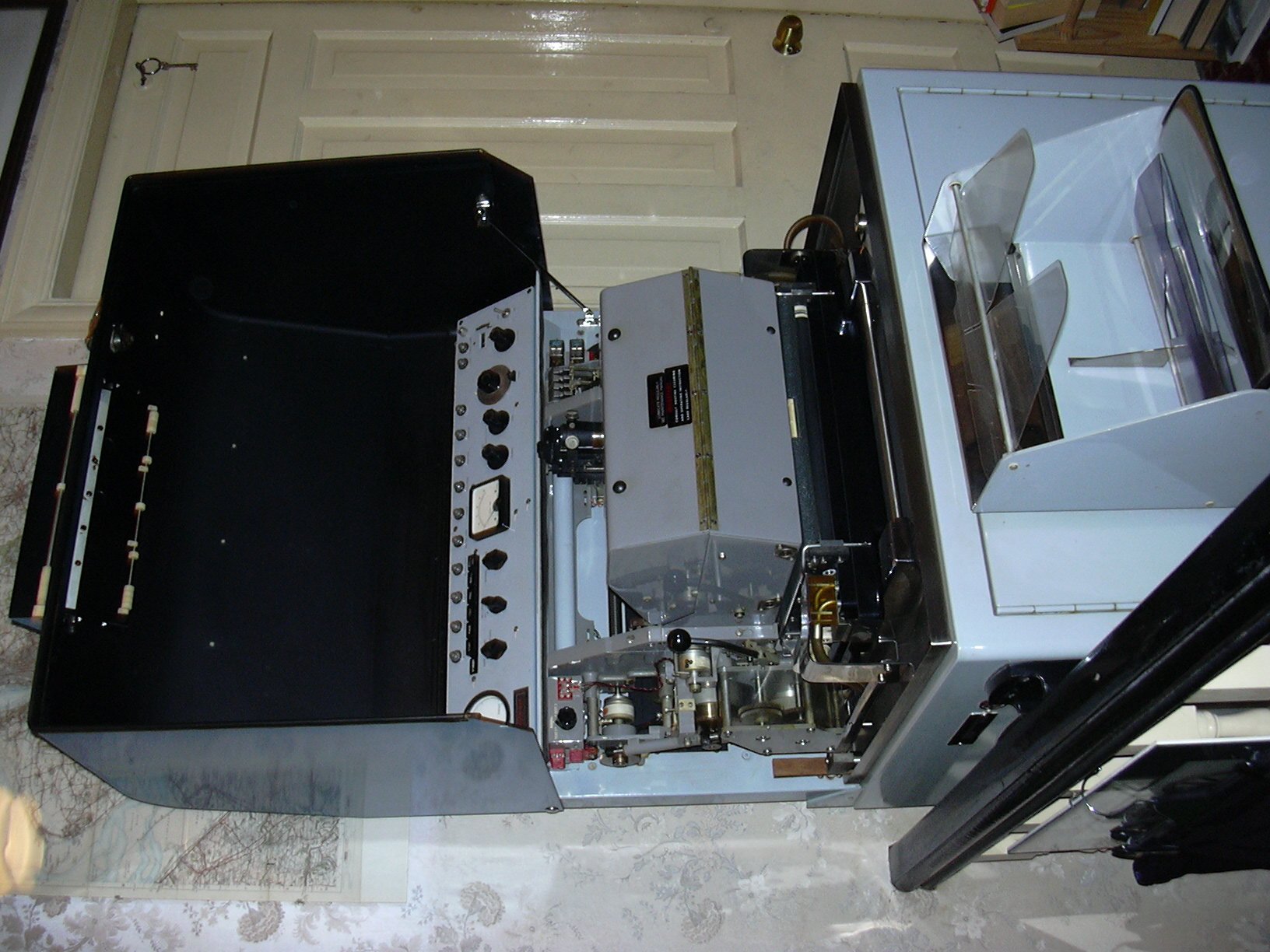
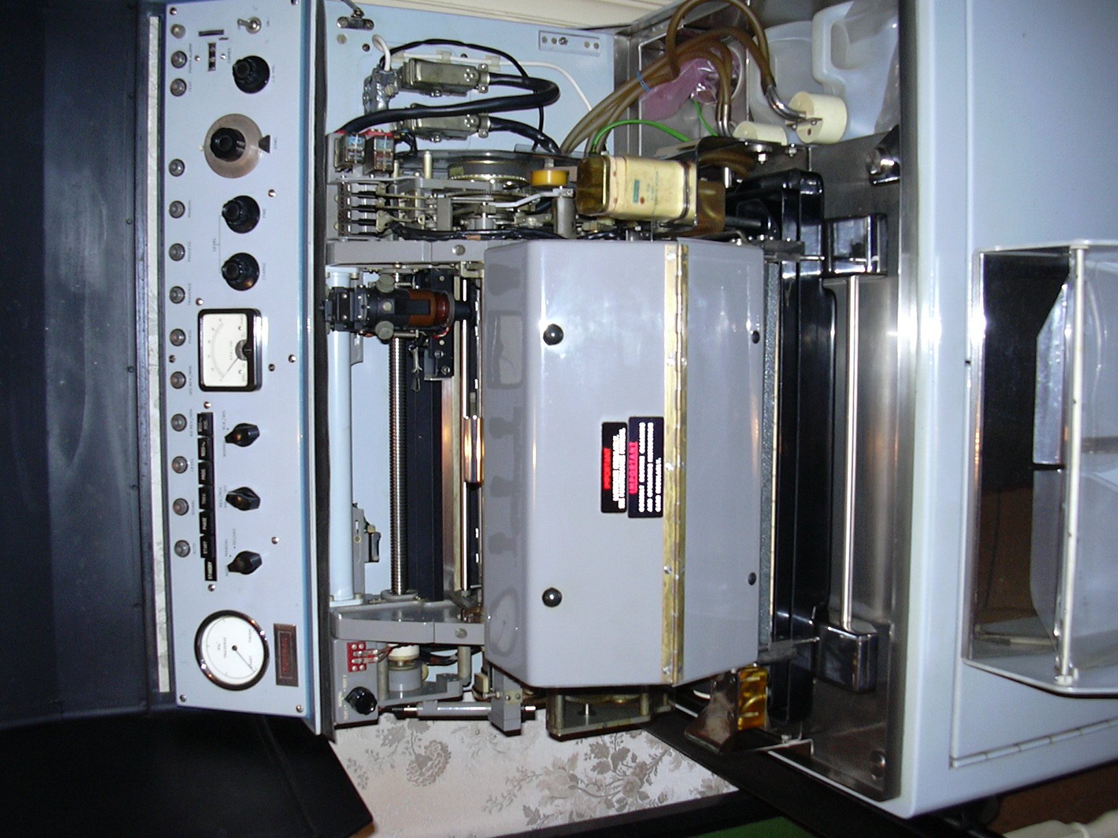
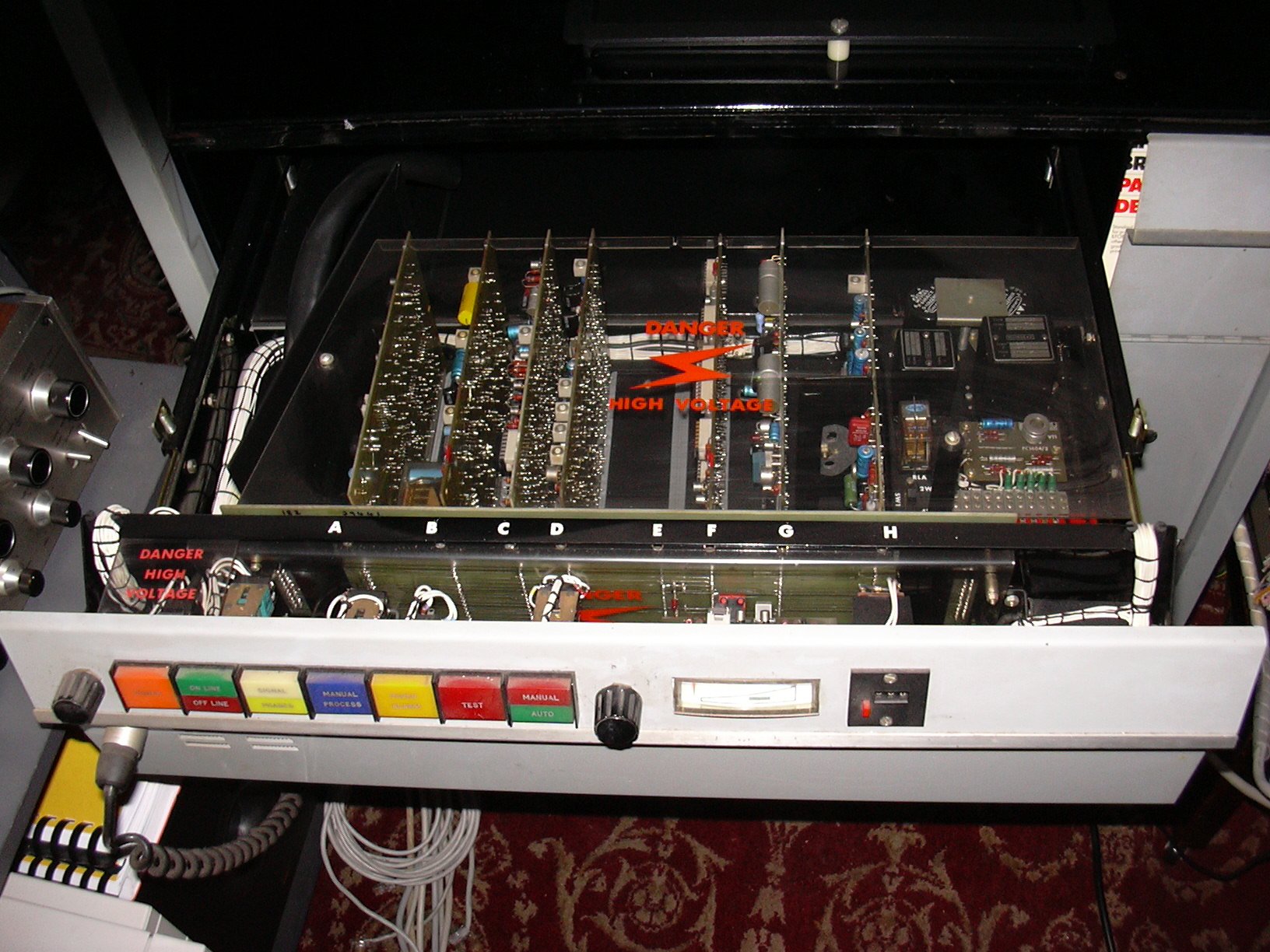
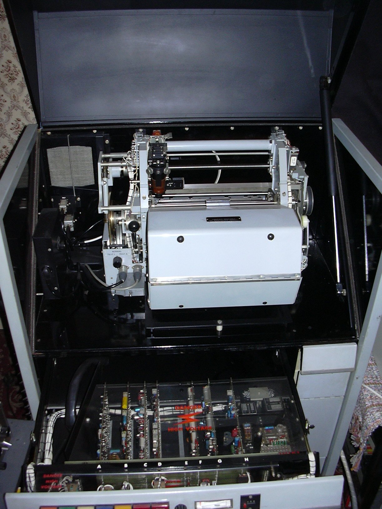
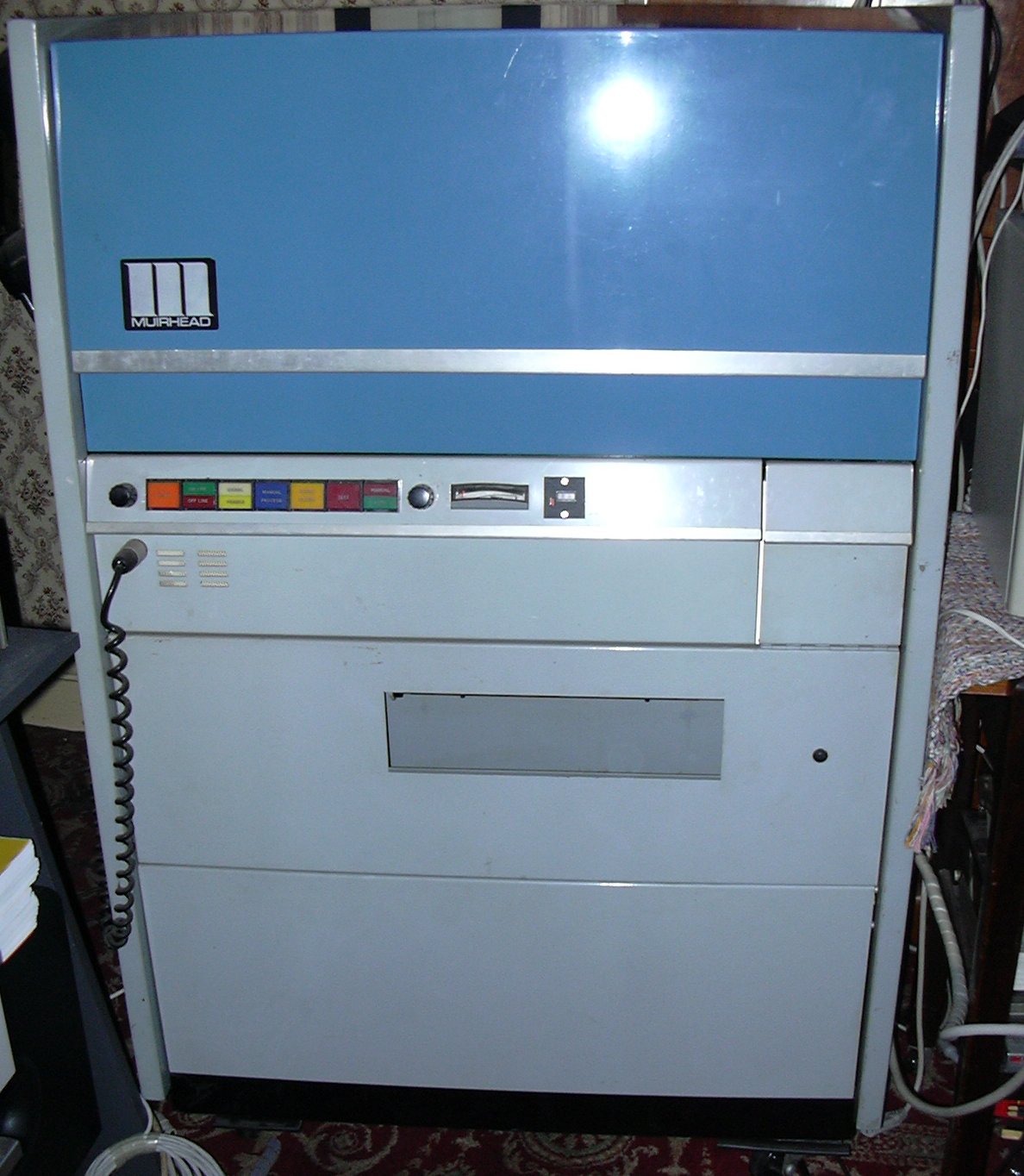
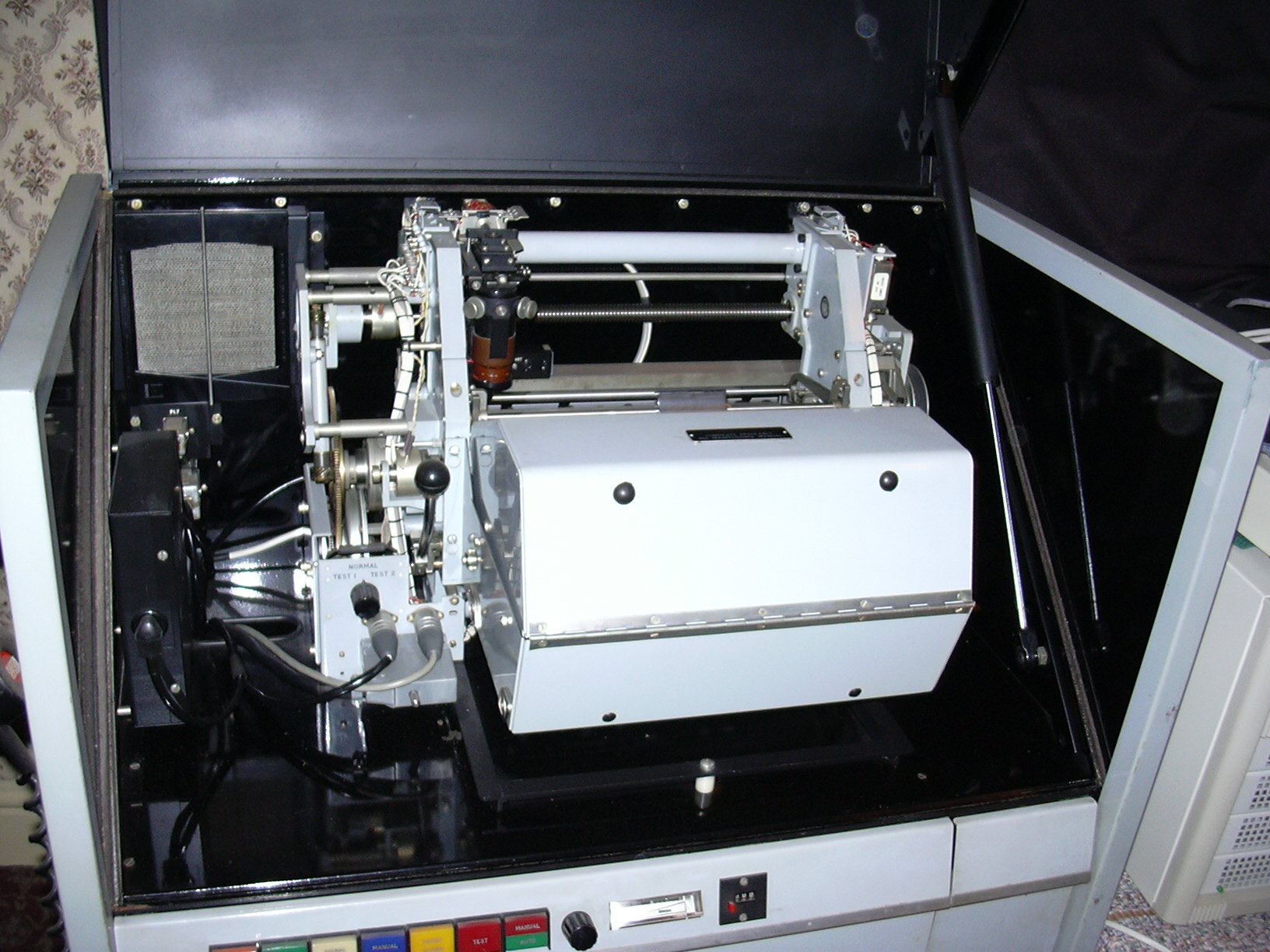
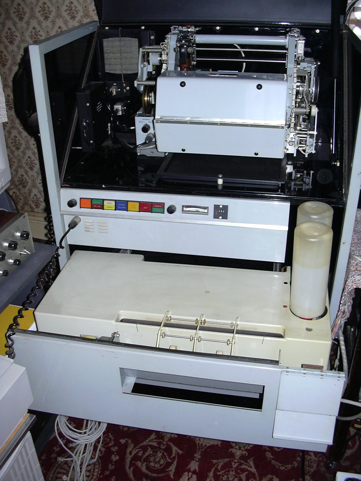
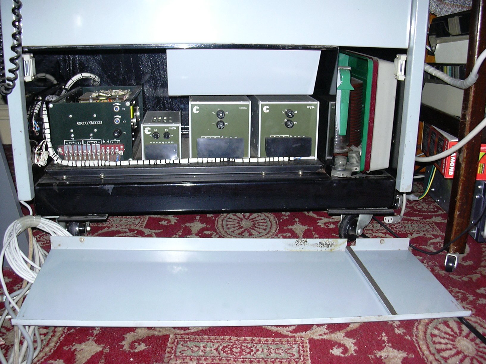
2. Current status of JMH With deterioration in budgetary conditions, enormous rental cost for NTT-East radio facilities and broadcasting services is a burden on other telecom plans. Furthermore nowadays it is more difficult and more expensive to maintain the current superannuated JMH system. Raymond Prestridge Weatherford, Texas, USA wrote also: Second, the Fukiushima Prefecture Fisheries chart you mention on "Last Info" I have received here. I would give the frequency as 8658 Khz, with a start time of 1004 UTC for the transmission. 90/576 is correct parameters. It seems to be broadcast everyday. Signal is good here, unfortunately there is some very near channel interference from a maritime utility station, which I believe is WLO. Earlier this morning 22.559.0 JFC: Misaki Fisheries Yokosuka 0030 FAX 120/576 prob ship disress notice in Japanese, chart headed JFC FAX (12 Apr 04) (ML2) Off air between xmissions, other charts copied this freq: 0140 120/576 - 6 pane chart, product unknown, poor copy 0310 90/576 - sea temp chart for NW Pacific 1030 90/576 - table, 130E-110W 12N-8S, barometer readings in inches Regards Murray Perth W AUS. Source WUN Add a new Discussion Forum to the Site Murray Lehmann, Australia received a UNID Fax station on 8657.5 KHz, using 90/576 at 10:00 UTC with a surface pressure chart (JMH) centred of Japan. This station is a fishery chart, and is from a fishery service in Fukiushima Prefecture. Revised the Radiofax Schedules with some links direct to the Fax Stations Add the Radio fax schedule from USCG Kodiak W6ELProp predicts ionospheric (sky-wave) propagation between any two locations on the earth on frequencies between 3 and 30 MHz. There is no charge for W6ELProp when used for non-commercial purposes Pete Stein, Liverpool have collected facsimile machines for some years and have specialised in Muirhead products because of their (comparative) ease of converting to the reception of weather satellite imagery. He has a couple of Muirhead photo fax machines one of which he keeping a K300 and one a K560 that will be skipped if no home is found for it soon. The unit was manufactured around 1970 and cost the MOD some £17000. It was bought to receive images from warships during the Icelandic Cod Wars and was thankfully correctly de-commisioned after a few months until Pete Stein bought it .It has a complete selection of spares including a mechanism unit and manuals it would be a real shame to scrap it but no one in the UK wants it, ok it is a little big, but is unused and has been kept warm and dry for many years. You are a 'long shot' but if you know anyone who would like it is free. If you have interrest feel free to send me a mail mrensen@hffax.de Look for some pictures of the Muirhead K300 K300 picture 1 (K300 Circuits 332Kb) Look for some pictures of the Muirhead K560 K560 picture 1 (K560 Cicuits 353Kb) Add the latest Fax Schedule from Nairobi Meteo (5YE) The mystery fax around 14690 kHz is a Basque organisation called AZTI (www.azti.es). This organisation receives HRPT images, study these images, and inform fisher boats where they can get better captures Source: Angel Aparicio, Spain via Peter Thomson, UK. The last version of the open source NOAA wheather satellite decoder software from Thierry Leconte called atpdec now available. Lot of small changes (bug fix, new AM demodulator front end, new false color generation code). There is a windows binary version available too now ... The home page is : http://atpdec.sourceforge.net The download page is : http://sourceforge.net/projects/atpdec atpdec don't have any fancy graphical interface. So after dezipping the atpdec13win.zip file, you will need to open a command line windows, change working dir to the atpdec dir, and then type something like : atpdec -i ac -d . c:\yourfile.wav and after a few seconds you will get your image in current working dir. Kristian K, Germany found a UNID Fax around 14.424.0 KHz tx daily at 08:20 UTC Download a sample from this UNID station Details of the new Meteosat schedule (PDF and TXT formats) effective 28th November 2000 now available from the EUMETSAT website. Web Counter reports |
||||||||||||||||||||||||||||||||||||||||||||||||||||||||||||||||||||||||||||||||||||||||||||||||||||||||||||||||||||||||||||||||||||||||||||||||||||||